High Willhays from Yes Tor (library pic)
This was my first outing of 2017 and the first during this seasons Winter Bonus. I have several trips lined up between now and the 15 March each of them taking in at least two summits for max point return per mile driven (bear in mind it usually takes me at least 3 hours drive each way and I do these trips in one day). Todays targets were the highest points of Devon – High Willhays within the Okehampton Army Firing Range and Somerset – Dunkery Beacon on Exmoor. I had done both these hills before but never as a single expedition. This trip would entail 8 hours driving for approximately 5 hours on the hills! So with sunrise scheduled at High Willhays for 0817 I departed home at 0500.
Equipment
FT-817 5 Watts, 4.2Ah LiFePO4, 40m/30m/20m linked dipole, 7m sotapole and a palm paddle, VX-8 plus RSS 2M dipole.
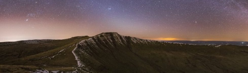
High Willhays G/DC-001
The start point for todays walk is within the bounds of the Army Firing Range and is accessed via the Army Camp just south of Okehampton. Access to the range is permissive depending on firing activities – check out MOD website for open access details. Do not be tempted to go at any other time and if the red flag is flying go elsewhere!
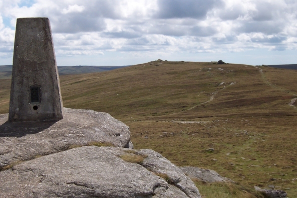
Parking at SX 590912 at the end of a metalled road. The route is fairly straight forward – follow the track until a fork, take the right fork over a ford and climb up towards the cull between Yes Tor and High Willhays. Today I decided to take in Yes Tor first so I turned right at the end of the good track and headed directly to the trig point on the rocky outcrop.

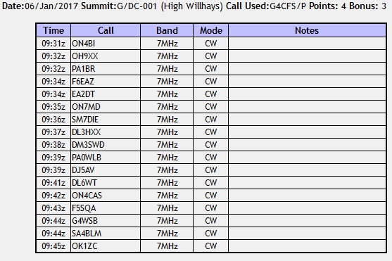
After a quick break and a chat to a passing walker, I headed south along the ridge to High Willhays. Setting up just below the summit I self spotted for 7-cw and almost immediately started getting a response. Within 15 minutes I had 17 stations in the log from 9 Countries so was well happy with the result. A quick check of 2-fm resulting in very strong data burst interference which I assumed came from the aerial on Yes Tor.
 The cloud had started to descend by now so I packed up and headed off back along the ridge to the top of the track then reversed my outbound track back to the car. Walk up to High Willhays via Yes Tor including chat 1 hour 30 minutes, time on summit 30 minutes, time back to the car 50 minutes.
Dunkery Beacon G/SC-001
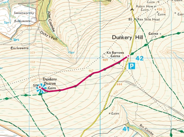
A 1 hour 45 minutes drive from Okehampton brought me to the lay-by opposite the track to Dunkery Beacon SS 904420. This is an easy walk to the summit along a well maintained path and this is the umpteenth time I have made the journey never to see the fantastic views from the summit. I am told there are good views across to Wales – I will have to accept that as true because every time I come here it rains or is in low claggy cloud. Well today was no exception – it was absolutely chucking it down!
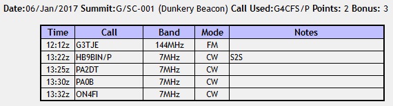
After a somewhat brisk yomp to the summit I called on 2-fm and managed a pleasant QSO with Peter G3TJE but had no other takers. So set-up for HF to find I had left the aerial in the boot of the car after sorting out the Ruck Sack at the end of High Willhays!!! Fortunately the summit was void of human ears because the air turned very blue very quickly. There was nothing for but to stash my Ruck Sack by the cairn and run/walk back down to the car and collect said aerial.
Arriving back at the summit 30 minutes later I finally set up and self spotted on 7-cw to find the bands had changed completely from this morning. In 10 minutes I only managed 4 contacts but the bonus was that the first contact was with Juerg HB9BIN/p on the summit of Monte Boglia in the Ticino region of Switzerland. Becoming concerned about rain getting into the radio gear I packed up and headed back to the car and the prospect of a nice 3.5 hour journey home.
Overall a good day out which can be divided into a day of two distinct halves. A great walk on Dartmoor with some excellent radio conditions followed by a duel ascent on Exmoor in pouring rain and lousy radio conditions (as I climbed Dunkery twice can I claim the points twice???).